Published on Thursday, 22 August 2024 at 2:10:28 PM
At the Ordinary Council Meeting on Tuesday 20 August 2024 Council endorsed the Coastal Hazard Risk Management and Adaptation Plan (CHRMAP).
The CHRMAP outlines how our coastline may change in the future and recommends the best options for managing future potential hazards and risks.
The Western Australian Planning Commission’s State Planning Policy No. 2.6: State Coastal Planning Policy addresses climate change, sea level rise, increased coastal inundation and coastal erosion. It recommends that management authorities develop and implement an effective CHRMAP in consultation with the local community.
The CHRMAP was completed in eight stages, with community and stakeholder engagement undertaken along the way.
The Shire engaged the services of Water Technology to manage the process and produce the CHRMAP, with funding provided by the Department of Planning, Lands and Heritage, with input from the Department of Transport.
The draft CHRMAP was endorsed by Council to go out for public comment via resolution number 64/24 at the July 2024 Ordinary Council Meeting. The five-week public comment period closed on 5 August 2024 with NIL comments received.
Hopetoun at risk
The Hopetoun region has been identified as an erosion hotspot. This means coastal erosion is expected to impact on public and private physical assets within 25 years.
The map below shows the assets at risk in 2122.
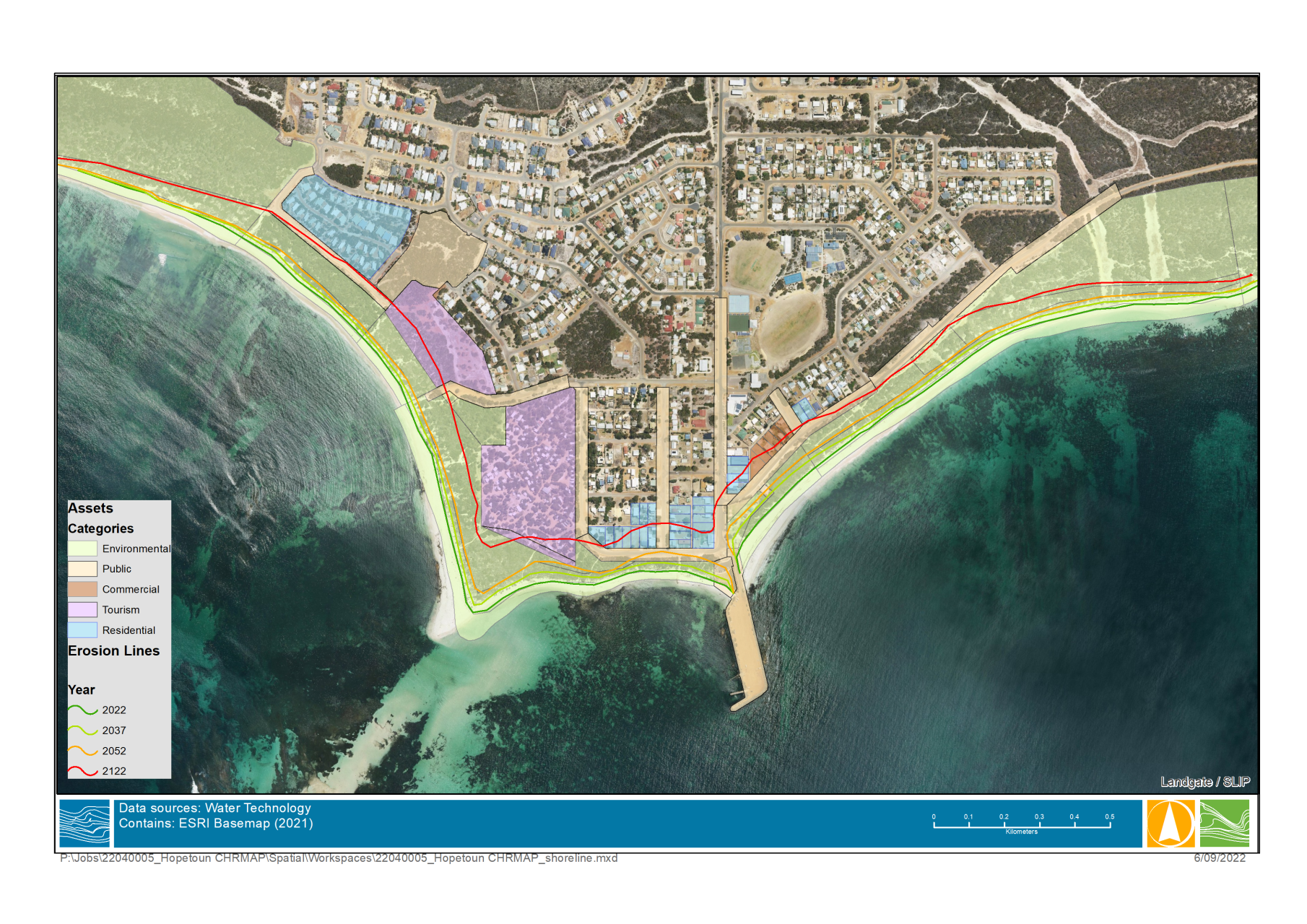
While this map shows the erosion over time.

Options for treating erosion
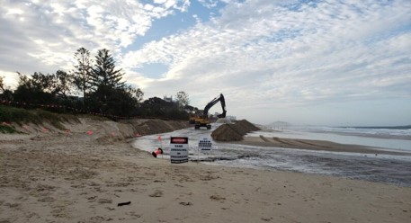
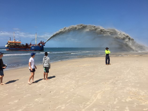
Several treatment options for erosion at Hopetoun are detailed in the CHRMAP.
The recommended action is protection with beach nourishment, which is replacing the sand lost through erosion with sand from another location.
Examples of beach nourishment can be seen in the two photographs below.
Want to know more about CHRMAP?
More information on the timeline of the project, including FAQS, can be found here.
Shire of Ravensthorpe CHRMAP
Back to All News